Creation of maps and charts for territory and tourism
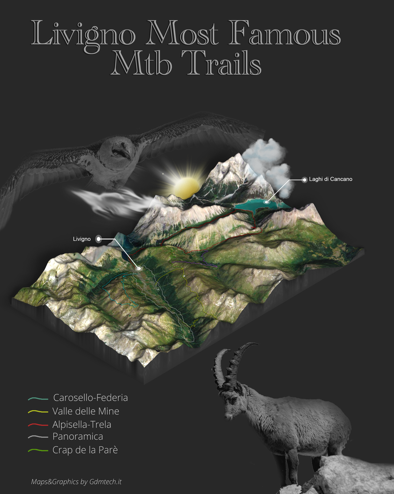
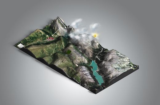
Maps and charts are still widely used today and remain truly fascinating. The creation of tourist maps and charts is our passion. We specialize in designing maps and charts for parks and nature reserves. Our 2D and 3D maps are perfect for illustrating trails, routes and itineraries of tourist destinations. Some examples of use: maps and charts for MTB and trekking routes. Maps and charts for running and trail running races. We create maps by accurately placing GPX tracks on the map with waypoints and POIs (points of interest). We design stunning illustrated 2D and 3D maps. We also produce folding maps for trails and routes. Maps for cycling and MTB races, trekking routes, camping areas and resorts, bike parks and ski resorts. Our specialty is creating maps for parks and nature reserves.
How do we create maps?
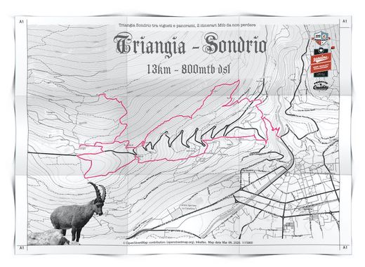
Maps are created starting from a style based on their use and destination. The cartographic base depends on the project. For a vintage-style map we use desaturated maps with contour lines and vintage illustrations. If the chart is modern, we use colored and shaded Opentopo bases. The map elements, the legend, and the distribution of elements differ for each project. Once the map style has been decided, we define the size, folding options and start creating the content. If trails and itineraries need to be illustrated, the client can provide GPX files that are precisely mapped with colors, labels and references.
Creation of 3D maps
Our maps are of two types: maps with satellite texture and real highmap relief, or illustrated vector maps. In both cases we enrich the maps with graphic elements, information and photos. The big difference between the two map types lies in the type of territory to be represented and the resolution required. For maps to be printed on large panels, illustrated vectors should be used, while for the web, social media and small prints, satellite textures can be used, as long as the territory is well represented. Our ‘infographic’ maps are also ideal for generating viral content for social networks.
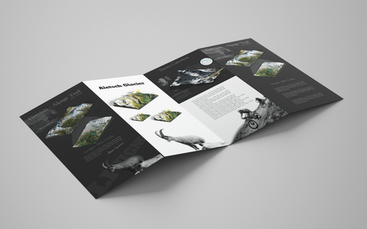
Creation of 2D and 3D maps for flyers and foldable leaflets
The charm of foldable maps is timeless. Combining the effectiveness of modern maps with the beauty of a paper map is still a great effect today. We design maps and charts for park trails and nature reserves. We map GPX tracks and waypoints onto the maps, with the option to connect directly to online resources via QR codes.